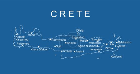
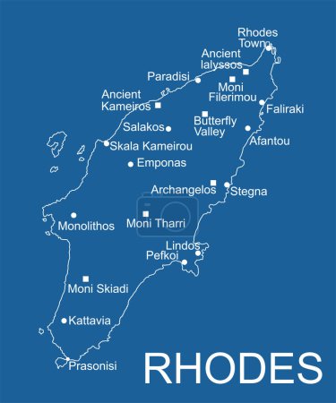
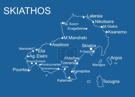
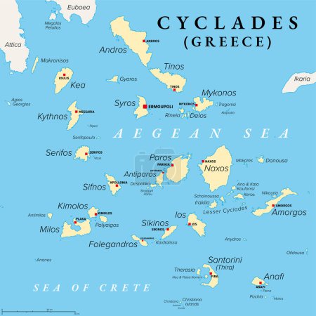
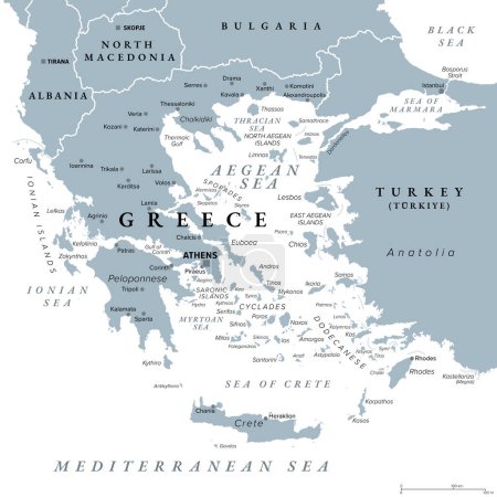
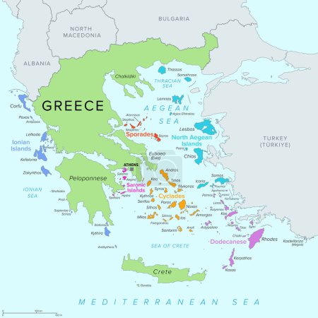
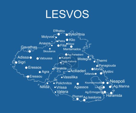
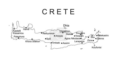
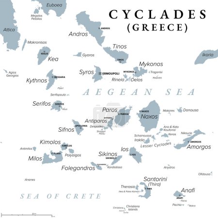
51 Vektoren zum Thema "mykonos map" bei ClipDealer

Medien sortieren nach     Gehe zu Seite:    
« Vorherige  1  Nächste »
Island of Mykonos in Greece vector map line contour silhouette illustration isolated on white background.
Mykonos map Blank vector map of the Island Borders of Mykonos for your infographic Vector
Mykonos map silhouette
Mykonos map Island silhouette icon Isolated Mykonos black map outline Vector illustration
Mykonos vector map Grunge rubber stamp with the name and map of island vector illustration Can be
Greece island Mykonos map vector line contour silhouette illustration isolated on black background.
Mykonos flag badge Vintage travel stamp with circular text stars and island flag inside it Vector
Mykonos logo sign Travel rubber stamp with the name and map of island vector illustration Can be
Greece island Mykonos map vector line contour silhouette illustration isolated on blue background.
The detailed map of Greece with regions or states and cities, capital. Administrative division.
Greece Map and Colorful Map Markers
Greece Political Map
Greece Map Isolated on White
Greece Political Map Isolated on White
Greece Political Map
Set of vector polygonal Mykonos maps filled with bright gradient of low poly art.
Map of the Aegean Sea, part of the Mediterranean between Greece and Turkey
Highly detailed physical map of Greece,in vector format,with all the relief forms,regions and big cities.
The detailed map of Greece with regions or states and cities, capital. Administrative division.
Island of Lefkada in Greece vector map silhouette high detailed illustration isolated on blue background. Ionian Island. Greek paradise island.
Island of Cephalonia in Greece vector map silhouette illustration isolated on blue background. Ithaki, Ithaca island near the Kefalonia.
Highly detailed physical map of Greece,in vector format,with all the relief forms,regions and big cities.
greece map with flag
Greece political map
Mykonos map with name
Island of Zakynthos in Greece vector map high detailed silhouette illustration isolated on white background.
Island of Lefkada in Greece vector map silhouette, high detailed illustration isolated on white background. Meganissi island, Skorpios island and Sparti island. Beautiful beach tourist paradise.
Zakynthos
Island of Lesvos in Greece vector map silhouette illustration isolated on white background. Lesbos map High detailed.
Santorini , Greece
Vector hand drawn stylized map of Greece cities. Travel illustration. Hellenic Republic geography illustration. Europe map element
Ionian Islands map, Greece, Europe. Filled and outline map designs. Vector illustration
Greece island Crete map vector line contour silhouette illustration isolated on blackbackground. Greek island map high detailed.
Greece island Corfu map vector line contour silhouette illustration isolated on black background. Greek paradise island.
Greece island Lefkada map vector line contour silhouette illustration isolated on blue background. Greek paradise Ionian  island.
Greece island Lefkada map vector line contour silhouette illustration isolated on black background. Greek paradise Ionian  island.
Greece, the Hellenic Republic, political map. Country in Southeast Europe on the southern tip of the Balkan peninsula, with capital Athens. Bordered by the Aegean, Ionian, and the Mediterranean Sea.
Greece island Crete map vector line contour silhouette illustration isolated on white background. Greek island map high detailed.
Greece island Rhodes map vector line contour isolated on blue background. High detailed silhouette illustration. Greek paradise island.
Greece island Skiathos map vector line contour silhouette illustration isolated on blue background.
Cyclades, group of Greek islands in the Aegean Sea, political map. Southeast of mainland Greece. Cyclades means encircling and it refers to the circle, the islands form around the sacred island Delos.
Greece, the Hellenic Republic, gray political map. Country in Southeast Europe on southern tip of the Balkan peninsula, with capital Athens. Bordered by the Aegean, Ionian, and the Mediterranean Sea.
Islands of Greece, political map. Greek islands groups and clusters. The Cyclades, Dodecanese, Sporades, North Aegean and Saronic Islands lying in the Aegean Sea, the Ionian Islands in the Ionian Sea.
Greece island Lesvos map vector line contour silhouette illustration isolated on blue background. Lesbos map High detailed.
Greece island Crete map vector line contour silhouette illustration isolated on white background. Greek island map high detailed.
Cyclades, group of Greek islands in the Aegean Sea, gray political map. Southeast of mainland Greece. Cyclades means encircling referring to the circle the islands form around the sacred island Delos.
Greece island Corfu map vector line contour silhouette illustration isolated on blue background. Greek paradise island.
Greece island Rhodes map vector line contour isolated on black background. High detailed silhouette illustration. Greek paradise island.
Greece island Skiathos map vector line contour silhouette illustration isolated on black background.

« Vorherige  1  Nächste »