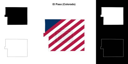
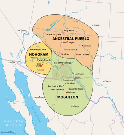
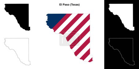
45 Vektoren zum Thema "El Paso vector map" bei ClipDealer

Medien sortieren nach     Gehe zu Seite:    
« Vorherige  1  Nächste »
USA map words cloud with larger american cities
abstract topographic map
USA Heart words cloud with larger american cities
Grunge rubber stamp with name of Texas, El Paso
El Paso County (Colorado) outline map set
El Paso Texas Travel Stamp Icon Skyline City Design Tourism
Urban vector city map of El Paso, Texas, United States of America
Texas's vector high detailed map showing counties formations. Largest cities skylines of Texas
map of the city of El Paso, Texas, USA
Urban vector city map of El Paso, Texas, United States of America
Simple map of El Paso, Texas, USA. Black and white version for clean backgrounds and prints. This map of El Paso contains three markers who are grouped and can be moved separetly in vector version.
Map of Texas
Urban vector city map of El Paso, Texas, United States of America
vector map of Texas's congressional districts since 2013. High detailed political map of Texasshowing counties formations
Texas, United States, political map
New Mexico, political map, with capital Santa Fe, borders, important cities, rivers and lakes.State in the Southwestern region of United States of America. English labeling. Illustration. Vector.
Texas County Map
USA Heart words cloud with larger american cities
New Mexico United States political map
United States, El Paso flat landmarks vector illustration. United States, El Paso line city with famous travel sights, skyline, design.
El Paso silhouette skyline. USA - El Paso vector city, american linear architecture, buildings. El Paso travel illustration, outline landmarks. USA flat icon, american line banner
USA map words cloud with larger american cities
Texas, El Paso stamp
Lubbock texas on blue background
Texas - flat collection of US states flags.
Grunge rubber stamp with name of El Paso, Texas
Set of Colorado map, united states of america. Flat concept icon symbol vector illustration .
Colorado map shape, united states of america. Flat concept icon symbol vector illustration .
Oasisamerica, a cultural region of Indigenous peoples in North America. Political map showing the extent of three major cultures within the American Southwest and Northern Mexico with modern borders.
Set of Colorado map, united states of america. Flat concept icon symbol vector illustration .
El Paso County (Texas) outline map set
Set of Colorado map, united states of america. Flat concept icon symbol vector illustration .
Colorado map shape, united states of america. Flat concept icon symbol vector illustration .
Set of Colorado map, united states of america. Flat concept icon symbol vector illustration .
Colorado map shape, united states of america. Flat concept icon symbol vector illustration .
Southwest region of the United States, gray political map. States of American Southwest, simply Southwest. Geographical and cultural region, bordered by Mexico. Arizona, New Mexico, Nevada and Texas.
Set of Colorado map, united states of america. Flat concept icon symbol vector illustration .
Colorado map shape, united states of america. Flat concept icon symbol vector illustration .
El Paso, Texas. Downtown vector map.

« Vorherige  1  Nächste »