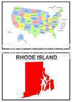
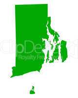
74 Bilder zum Thema "rhode island map" bei ClipDealer

Medien sortieren nach     Gehe zu Seite:    
« Vorherige  1  2  
USA Landkarte Staat Stars & Stripes Rhode island
USA Landkarte Staat Rhode Island
USA Landkarte Staat Stars & Stripes Rhode island
Karte von Rhode Island
rhode island state illustration
Amerikanische Bundesstaaten einzeln im Stars & Stripes Design
Providance USA map background
Rhode Island (USA) map
Map Of Rhode Island State 3d Shape
Rhode Island US state in watercolor
US State Maps Set II
Map of USA
State of Rhode Island map
Map of USA
Rhode Island RI Skyline City Metropolitan Area Nightlife 3d Illustration
Map of Rhode Island state, USA
american dollar banknotes forming and the map of Rhode Island State and white background
USA American Rhode Island State Map outline with grunge effect f
USA State Map Rhode Island
Flag of Rhode Island
Rhode Island sign board
Rhode Island
Atlantic coast of the United States night lights and sunrise with lens flare from the space station. Earth with eclipse on starry sky. Elements of this image furnished by NASA.
Rhode Island in the North Atlantic Ocean, belonging to United States, cropped to square on a satellite image taken in September 27, 2019
Rhode Island in the North Atlantic Ocean - belonging to United States. Described location diagram with yellow shape of the island and sample maps of its surroundings
Map of the State Rhode Island (United States of America) showing the isolated territory with relief representation, water bodies like seas, rivers, lakes and with borders. No labels at all.
Shape of Rhode Island in the North Atlantic Ocean, belonging to United States
Rhode Island in the North Atlantic Ocean on a topographic, OSM standard style map
Rhode Island in the North Atlantic Ocean, belonging to United States, described and highlighted on a bilevel elevation map
Rhode Island in the North Atlantic Ocean on a colored elevation map
Rhode Island in the North Atlantic Ocean, belonging to United States, cropped to square on a topographic, OSM standard style map
Rhode Island in the North Atlantic Ocean on a topographic, OSM Humanitarian style map
Rhode Island in the North Atlantic Ocean, belonging to United States, isolated on a satellite image taken in September 27, 2019, with distance scale
Map of United States made of license plates
rhode island on map of usa
Map of Rhode Island
Rhode Island in the North Atlantic Ocean, belonging to United States, isolated on a topographic, OSM Humanitarian style map, with distance scale
Rhode Island in the North Atlantic Ocean, belonging to United States, cropped to square on a colored elevation map
Symbol Map of the State Rhode Island (United States of America) showing the outline of the state as an asphalt surface
Symbol Map of the State Rhode Island (United States of America) showing the territory of the state as a lawn football field
Rhode Island in the North Atlantic Ocean on a bilevel elevation map
Rhode Island in the North Atlantic Ocean on a satellite image taken in September 27, 2019
Rhode Island in the North Atlantic Ocean, belonging to United States, described and highlighted on a topographic, OSM Humanitarian style map
Rhode Island in the North Atlantic Ocean, belonging to United States, isolated on a bilevel elevation map, with distance scale
Rhode Island in the North Atlantic Ocean on a satellite image taken in June 8, 2020
Rhode Island in the North Atlantic Ocean, belonging to United States, described and highlighted on a satellite image taken in June 8, 2020
State of Connecticut map
States of the US
Flag and map of Rhode Island
Flag of Rhode Island (USA)
Rhode Island Red State Map
Rhode Island flag - USA state flags collection
Rhode Island  State Map
Rhode Island administrative map. counties map of Rhode Island with different brown colours, blank Map, empty map of Rhode Island
Rhode Island administrative map. counties map of Rhode Island with different sky colours, blank Map, empty map of Rhode Island
Rhode Island outline County map set - illustration version

« Vorherige  1  2